| New England 100 Highest List ↓ |
| Mount Abraham - Maine |
| Mount Abraham - Vermont |
| Mount Adams |
| Baldpate Mountain |
| Mount Bigelow, Avery Peak |
| Mount Bigelow, West Peak |
| Mount Bigelow, South Horn |
| Big Jay |
| Mount Bond |
| Bondcliff |
| Mount Bond, West Peak |
| Boundary Peak |
| Bread Loaf Mountain |
| Mount Cabot |
| Camel's Hump |
| Cannon Mountain |
| Cannon Ball, Northeast Peak |
| Mount Carrigain |
| Carter Dome |
| Carter, Middle |
| Carter, South |
| Mount Coe |
| Crocker Mountain |
| Crocker Mountain, South |
| Dorset Mountain |
| Mount Eisenhower |
| Elephant Mountain |
| Mount Ellen |
| Equinox Mountain |
| Mount Field |
| Mount Flume |
| Fort Mountain |
| Mount Galehead |
| Mount Garfield |
| Goose Eye Mountain |
| Mount Hale |
| Mount Hancock |
| Mount Hancock, South Peak |
| Mount Isolation |
| Mount Jackson |
| Jay Peak |
| Mount Jefferson |
| Mount Katahdin, Baxter Peak |
| Mount Katahdin, Hamlin Peak |
| Kennebago Divide |
| East Kennebago Mountain |
| Killington Peak |
| Mount Kinsman, North Peak |
| Mount Kinsman, South Peak |
| Mount Lafayette |
| Mount Liberty |
| Mount Lincoln |
| Mount Madison |
| Mount Mansfield |
| Mendon Peak |
| Mount Monroe |
| Mount Moosilauke |
| Mount Moriah |
| Mount Nancy |
| North Brother Mountain |
| Old Speck Mountain |
| Mount Osceola |
| Mount Osceola, East Peak |
| Owl's Head |
| Mount Passaconway |
| Peak Above the Nubble (PATN) |
| Pico Peak |
| Mount Pierce |
| Mount Redington |
| Saddleback Mountain |
| Saddleback Mountain, The Horn |
| Sandwich Mountain |
| Scar Ridge |
| Sleeper, East Peak |
| Snow Mountain - Franklin County |
| Snow Mountain - Oxford County |
| South Brother |
| Spauling Mountain |
| Stratton Mountain |
| Sugarloaf Mountain |
| Mount Tecumseh |
| The Bulge |
| The Horn |
| Mount Tom |
| Mount Tripyramid, Middle Peak |
| Mount Tripyramid, North Peak |
| Mount Twin, North Peak |
| Mount Twin, South Peak |
| Vose Spur |
| Mount Washington |
| Mount Waumbek |
| Mount Weeks |
| Mount Weeks, South |
| White Cap Mountain |
| Mount Whiteface |
| Mount Wildcat, A Peak |
| Mount Wildcat, D Peak |
| Mount Willey |
| Mount Wilson |
Zealand Mountain |
|
|
Hike Bread Loaf Mountain |
| |
| On this page: Information | Trail maps | View Photos | Driving Directions |
| |
| Bread Loaf Mountain Information |
Elevation: 3,835 feet (1,169 meters)
Prominence:  1,430 feet (440 meters) 1,430 feet (440 meters)
Location: Ripton, Vermont (Addison County)
Range: Green Mountains
Coordinates: 44°0.13' North 72°56.48' West
Rating: Moderate - For an almost 4,000 foot mountain, this hike is relatively easy-going with low inclines and a few rock scrambles. There is only one area where the hike gets steeper than it was, but it is not bad. If the weather is on your side, this hike is rather pleasant.
Features: Skyline Lodge, Long Trail, Peak Bag
Distance of highlighted hike below: 10.4 miles with Mount Wilson
|
 |
Bread Loaf Mountain is a 3,835 foot mountain located in Ripton, Vermont in Addison County in the famous Green Mountains. There are several ways to access the summit; Via the Skyline Pond Trail, off USFS 59 (Steam Mill Road), via the Clark Brook Trail off USFS 55, or via the Emily Proctor Trail off USFS 201.
Bread Loaf is flanked to the Northeast by Mount Wilson. Often these 2 mountains are peak-bagged together, since they are both on the New England Hundred highest hiking list.
|
| Bread Loaf Mountain Trail Maps - Directions from the parking lot to the summit |
Top |
The map below shows how to get to the summit of Bread Loaf Mountain as well as Mount Wilson via the Skyline Pond Trail and Long Trail. (There are several other beginning options as you can see from the map below.)
Hike on the Skyline Pond Trail for 2.5 miles until you come to a junction with the Long Trail; here you will go left on the Long Trail. Hike for 1.2 miles until you come to a spur trail on the left for Bread Loaf Mountain. (This is at the hair-pin turn on the Long Trail). Hike roughly 0.1 miles to the summit of Bread Loaf. After enjoying the summit, to head over to Mount Wilson, go back down the spur trail getting yourself back on the Long Trail. Go left on the Long Trail (right will take you where you were before). Hike for 0.6 miles until you come to a junction with the Emily Proctor Trail. Continue along the Long Trail (NOT turning left onto the Emily Proctor Trail). Hike for roughly 0.8 miles to the summit of Mount Wilson.
To get back to the Skyline Pond Traillhead parking area, retrace your steps back the way you came.
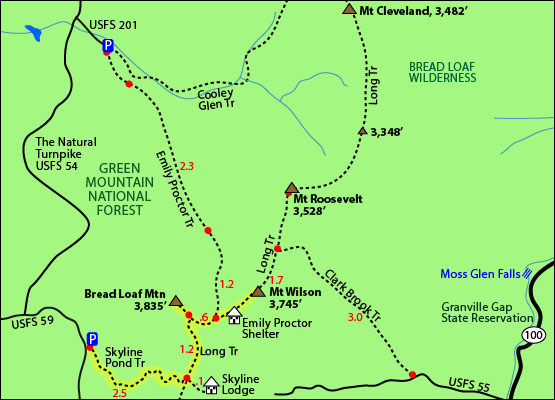
Click to download PDF Trail Map of Bread Loaf Mountain and Mount Wilson
|
| |
|
| |
| Bread Loaf Mountain View Photos |
Top |
|
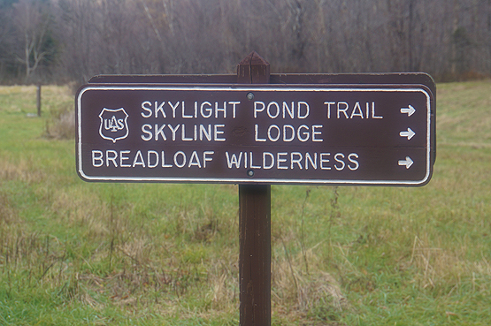
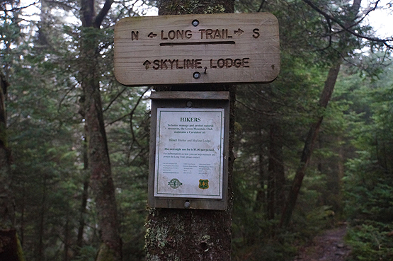
Parking area sign. Taken on October 30, 2014.
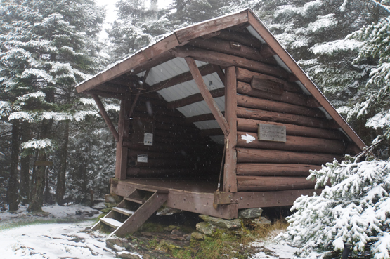
Emily Proctor Shelter. Taken on October 30, 2014.
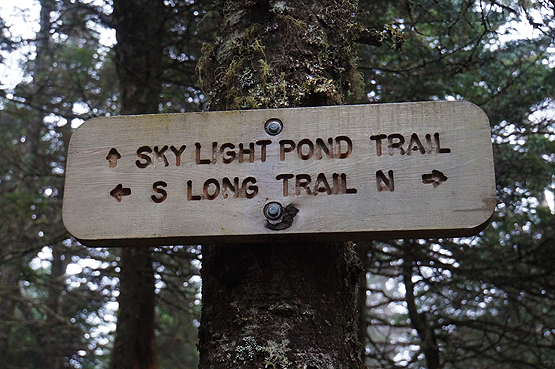
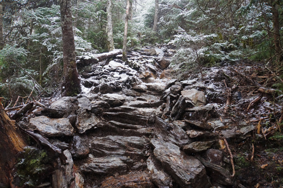
Long Trail. Taken on October 30, 2014.
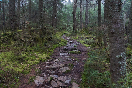
Skyline Pond Trail. Taken on October 30, 2014.
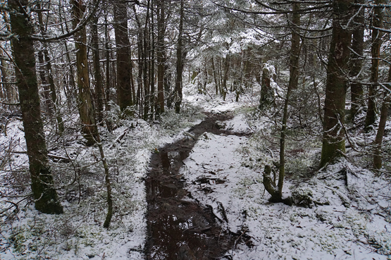
Skyline Pond Trail. Taken on October 30, 2014.
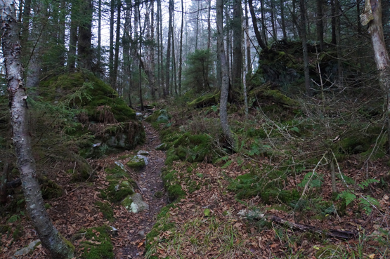
Taken on October 30, 2014.
|
| Bread Loaf Mountain Driving Directions for the Skyline Pond Traillhead |
Top |
If you have a GPS, you can enter the intersection of Steam Mill Road and College Cross Road in Ripton, Vermont. Once you turn onto Steam Mill Road, the traillhead is ROUGHLY 3.4 miles away.
From I-93 North, take the exit for I-89 North.
Take exit 3 off I-89 North for VT-107.
Turn right off the exit onto VT-107 West.
Drive 2.8 miles and continue onto VT-12 North.
Drive 0.4 miles and turn left to stay on VT-12 North.
Drive 0.3 miles to stay onto VT-12 North.
Drive 2 miles and turn left onto Camp Brook Road.
Drive 6.1 miles and continue onto Bethel Mountain Road.
Drive 4.1 miles and turn right onto VT-100 North.
Drive 4.3 miles and turn left onto VT-125 West.
Drive 8.7 miles and turn right onto College Cross Road.
Drive 0.2 miles and turn right onto Steam Mill Road.
Drive roughly 3.4 miles to the traillhlead for the Skyline Pond Trail.
|
|
On this page: Information | Trail maps | View Photos | Driving Directions | Top
|
|
|
|
|
|
|
|
|
|
|
|
|
| |
| |
|
| New Hampshire 4,000 Footers |
Vermont + Maine 4,000 Footers |
Other Hiking Lists / Patches |
New England Mountain Ranges |
Stay Involved in New England |
New Hampshire
Mount Adams
Mount Bond
Bondcliff
Mount Bond, West Peak
Mount Cabot
Cannon Mountain
Mount Carrigain
Carter Dome
Carter, Middle
Carter, South
Mount Eisenhower
Mount Field
Mount Flume
Mount Galehead
Mount Garfield
Mount Hale
Mount Hancock
Mount Hancock, South Peak
Mount Isolation
Mount Jackson
Mount Jefferson
Mount Kinsman, North Peak
Mount Kinsman, South Peak
Mount Lafayette
Mount Liberty
Mount Lincoln
Mount Madison
Mount Monroe
Mount Moosilauke
Mount Moriah
Mount Osceola
Mount Osceola, East Peak
Owl's Head
Mount Passaconway
Mount Pierce
Mount Tecumseh
Mount Tom
Mount Tripyramid, Middle Peak
Mount Tripyramid, North Peak
Mount Twin, North Peak
Mount Twin, South Peak
Mount Washington
Mount Waumbek
Mount Whiteface
Mount Wildcat, A Peak
Mount Wildcat, D Peak
Mount Willey
Zealand Mountain |
Vermont
Mount Abraham
Camel's Hump
Mount Ellen
Killington Peak
Mount Mansfield
Maine
Mount Abraham
Mount Bigelow, Avery Peak
Mount Bigelow, West Peak
Crocker Mountain
Crocker Mountain, South
Mount Katahdin, Baxter Peak
Mount Katahdin, Hamlin Peak
North Brother Mountain
Old Speck Mountain
Mount Redington
Saddleback Mountain
Saddleback Mountain, The Horn
Spaulding Mountain
Sugarloaf Mountain |
NH 4,000 footers
NH 4,000 footers in Winter
New England 4,000 footers
NE 4,000 footers in Winter
NH Hundred Highest
New England Fifty Finest
52 With a view
Trailwrights 72 summit club
New England Hundred highest
NE Hundred highest in Winter
Northeast 111
48x12 "The Grid"
Red Lining
Belknap Range
LRCT / Castle in the Clouds
NH Fire Tower Quest
Hike by - Alphabetically
Hike by - Elevation
Hike by - Prominence
Hike by - Mountain Range |
Ranges in New Hampshire
View all NH mountain ranges
Baldface-Royce Range
Carter-Moriah Range
Dartmouth Range
Franconia Range
Kinsman Range
Mahoosuc
Range
Ossipee Mountains
Northern Ranges
Pemigewasset Wilderness
Pilot Range
Pliny Range
Presidential Range
Sandwich Range
Twin Range
Wapack Range
Western White Mountains
Willey Range
Ranges in Maine
View all ME mountain ranges
Baxter State Park
High Peaks
Bigelow Range
Eastern White Mountains
Ranges in Vermont
Green Mountains
Other VT mountain ranges |
NH Waterfalls
NH AMC Huts
Hiker's store |
New England 4,000 Footers | NH 4,000 Footers | VT 4,000 Footers | ME 4,000 Footers | Hiking Lists & Patches | Hiker's Store | Contact by email
© www.4000footers.com 2015. All rights reserved. We are not affiliated with the AMC or the AMC Four Thousand Footer Club |
|
|